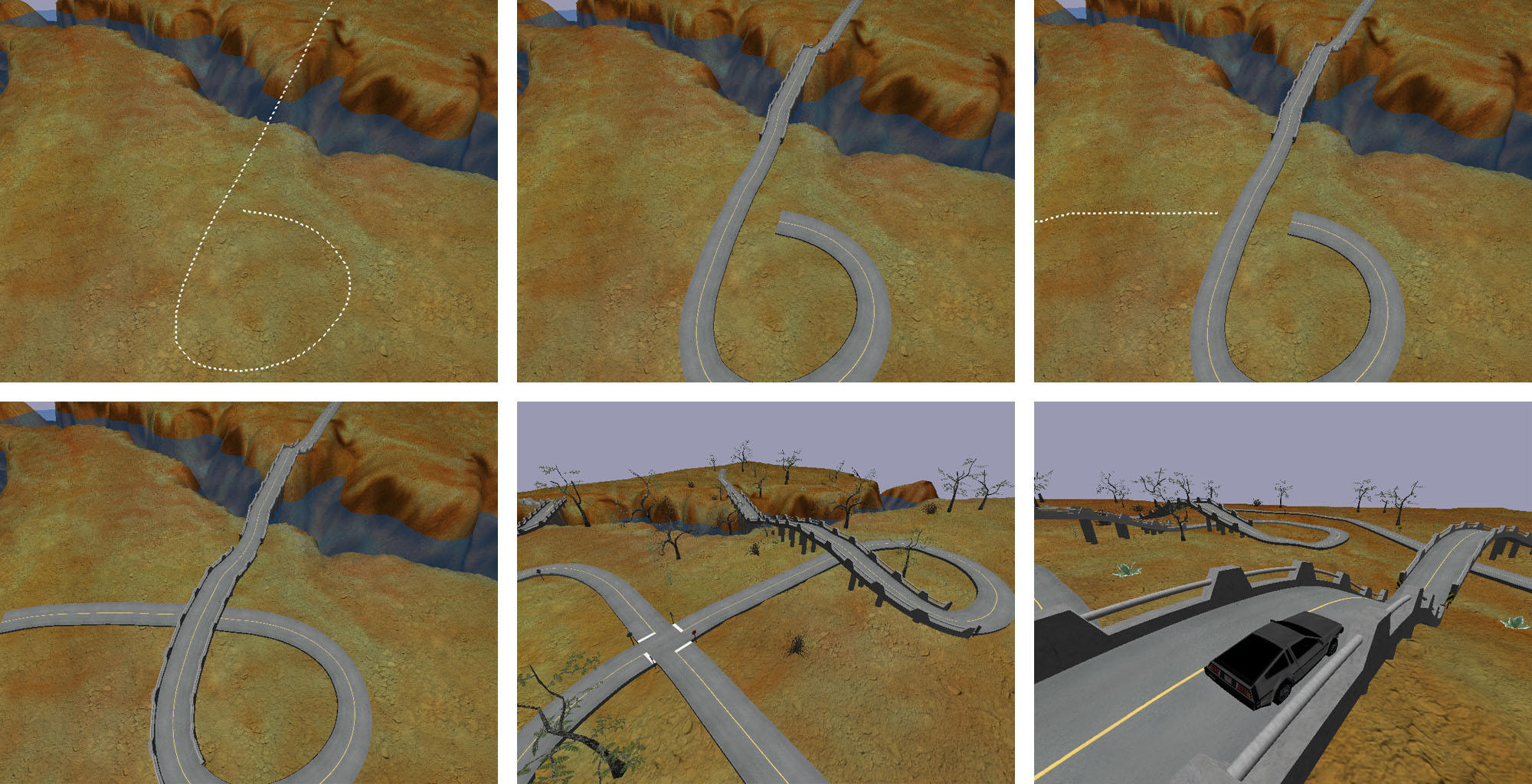
- curves instead of polylines, for the centerlines
- linear edges indicating the location of a curb or pavement
edge
- example: the GIS data of the City of Palo Alto
- polygonal extent of road area
- example: Transportation features layer of New York's NYCMap
- centerlines per lane, instead of the whole road
 A standard for road networks, begun 2006 by German company
VIRES; cooperation from Daimler AG
and TÜV Süd
A standard for road networks, begun 2006 by German company
VIRES; cooperation from Daimler AG
and TÜV Süd- Clean XML syntax, simple topology, roads are described by curve sections. Format extension is ".xodr"
- Evaluated version 1.2 of the spec in March 2009, and determined some
drawbacks:
- It's not a geo format. There is no CRS tag, and coordinates seem to be in some local system (like CAD, not GIS). In theory, perhaps you could put geocoords in there, and either insert a non-standard CRS element or use an external .prj file.
- Converting existing data (DLG, Shapefiles, OpenStreetMap, etc.) would be non-trivial. In particular converting/guessing the geometry from polylines to curve-sections would be messy, and get much messier at junctions.
- Lots of common things aren't there - e.g. crosswalks, dirt/gravel roads, train tracks, parking lots
- No open implementation code.
- With version 1.3 as of August 2010, there are some improvements
- There is an open implementation now, OpenCRG, which both implements and extends OpenDRIVE with attributes like surface descriptions (the <surface> tag)
- 1.3 also adds support for clothoids (curves with a linear rate of change) in addition to the straight and fixed curves of 1.2

- an ESRI Transportation Data Model, apparently in conjunction with NCGIA (UCSB)
- not a file format, but a recommended data organization to allow sharing of data
- three optional representations for "road":
- Single centerline - for one roadway, regardless of lanes, etc.
- CarriageWay representation - one centerline per set of lanes going the same direction
- Lane representation
- these are only briefly described in their user guide, and need to be investigated further
- presumably, they are GML2 profiles
- a consortium and standard for very, very detailed road descriptions, down to specific physical properties of the road surface, precise curvatures, and exact profiles
- this is a level of detail which is needed for some kinds of safety analysis, but is overkill for general modeling and visualization needs
 EDF
- Environment Description Framework (2003)
EDF
- Environment Description Framework (2003)- a transportation network representation developed by Pete Willemsen of the University of Utah
- described in Behavior and Scenario Modeling for Real-time Virtual Environments (pdf)
- additional info in Ribbon Networks for Modeling Navigable Paths of Autonomous Agents in Virtual Urban Environments, 2003 (pdf)
- allows for very detailed modelling of intersections, while astutely observing "Intersections are logically complicated, messy, and notoriously difficult to model, both geometrically and behaviorally."
- "Geographic Data Files", a specification for encoding transportation networks primarily with the purpose of trip planning, vehicle navigation and map display
- It is mentioned as being in use by "intelligent transportation system" (ITS) companies like TeleAtlas and NavTech, and you can buy some European road data in GDF format
- Amazingly wide scope - besides roadways, it supports encoding public transit, waterways, road signs, and much more
- It was apparently granted status as standard ISO/TR 14825:1996 which corresponds to version 3.0 of the GDF, reportedly attempts are underway to bring the ISO up to date with version 4.0, but i cannot find any online description of 4.0
- The GSDI Geospatial One-Stop site has a document on Data Content Standards For Transportation: Roads (pdf, April 2003) which references GDF along with many other systems
- X-GDF
- The scope of GDF4.0 was “frozen” in 2000, so from 2001 onwards work has been done on an "eXtended GDF", which harmonizes with other standards, and adds "support for 2D and 3D map display"
- There is a 2005 paper, “X-GDF” - The ISO Model of Geographic Information for ITS
- separate documents for Road, Railroad, Transit, Air, and Waterway
- these 'standards' had the input of U.S. federal agencies, ESRI, and other commercial companies
- it is hard to tell if these are guidelines or specifications, whether they augment or conflict with other specs such as UNETRANS or GDF, and whether and how people are expected to utilize them