VGIS
(Virtual
Geographic Information System)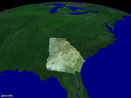
- based on 1996 Lindstrom-Koller algorithm
- project at Georgia Tech, managed by professor Bill Ribarsky
- Frank Jiang is the research scientist/programmer/manager for VGIS
- multi-platform: SGI, SUN, and NT/OpenGL/E&S
- pc version has been run with 4, 2, and 1 processors
- only documentation is a 10-page "system paper" overview:
- "An Integrated Global GIS and Visual Simulation System", Peter
Lindstrom, David Koller, William Ribarsky, Larry F. Hodges, Augusto Op den Bosch, and Nick
Faust. Abstract. GVU
Technical Report 97-07.
- multi-threaded: at least 3 very active threads
- 1: terrain manager - update current view, view culling, create display
list
- 2: terrain server
- 3: rendering
- terrain AND texture data is stored as GSD format, converted from IMG and
others
- received VGIS demo. Issues:
- navigation is awkward (no documentation, no control of viewpoint roll)
- threads eat 100% of CPU time on both CPUs, even with a totally static
view
- although demo supposedly includes elevation data, the landscape appears
totally flat
- lacks wireframe option, so degree of tessellation can't be seen
- large display glitches at high altitudes (could be fault of the card's
16-bit Z-buffer)
- threads get upset when the display window is minimized
- what do "Elevation Threshold" (0-10) and "Texture
Threshold" (0-10) do?
- changing these values had no visible effect on the scene