 City
of Las Vegas
City
of Las Vegas-
February 23, 2007: New 3D Buildings in Las Vegas. Google Earth's 3DWarehouse now includes new buildings for Las Vegas (kmz), including over 50 models of the hotels and casinos.
City
of Las VegasFebruary 23, 2007: New 3D Buildings in Las Vegas. Google Earth's 3DWarehouse now includes new buildings for Las Vegas (kmz), including over 50 models of the hotels and casinos.
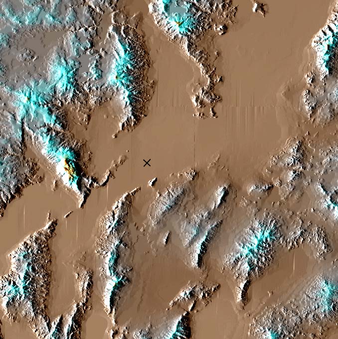
 1999 VTP
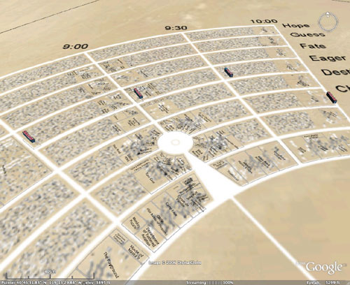
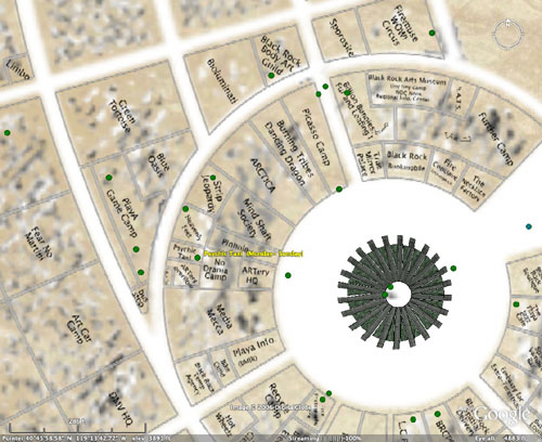
Demo: Black Rock City, Nevada
1999 VTP
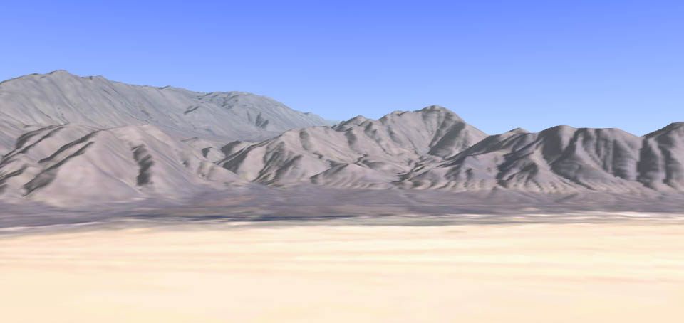
Demo: Black Rock City, Nevada"Black Rock City" is a temporary city built each year for the Burning Man festival, in the Black Rock Desert (BRD) of northeast Nevada, around 150 km north of Reno. In 1999, a VTP simulation of the area was assembled, and exhibited at the festival.
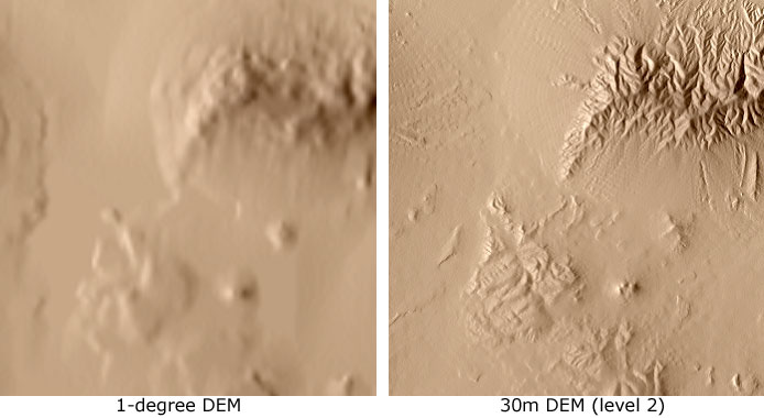
 because
the terrain is so bleak, elevation is the data source that contributes most
to visualization
because
the terrain is so bleak, elevation is the data source that contributes most
to visualization
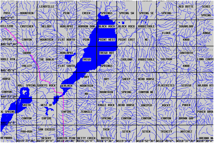
Quad Name 10m 30m 10m file # 30m file# Smith Canyon X 1650434 West of empire X 1650250 Empire X 1650428 Ten mile X 1650191 Eagle Rock spring X 1650182 Dead Horse canyon X 1650171 Juniper canyon X 1649992 Wall spring X 1706507 Godeys rock X 1706508 Gerlach X 1706509 Dry Mountain NW X 1706510 Dry Mountain X 1706511 Sheep Spring X 1650170 Dead Horse Canyon NE X 1649991 Squaw Valley X X 1706496 1650433 The Banjo X X 1706497 1651576 Hualapai Flat S X 1706498 Trego X 1706499 Trego Hot Springs X 1706500 Cholona X 1706501 Rabbithole X X 1706502 1675032 Crutcher Canyon X X 1706485 1650432 Melody Mountain X X 1706486 1651829 Hualapai Flat N X 1706487 Mormon Dan Peak X X 1706488 1651575 Black Rock Point W X X 1706489 1650853 Black Rock Point E X X 1706490 1650854 Rabbithole NE X 1706491
p043r032_7p20000531 has most of
the area, some of the northern BRD is on tile p043r031_7p19990630
 Looks
like Google acquired an aerial photo of the Burning Man 2006 event and has
incorporated it as part of the
big update pushed out today.
Check it out here. Also, you can
view it in Google Maps. It looks like an aerial photo showing the event
during its busiest time. The event was held on August 28 through September
4th, so this data is only a month old! How's that for current data? The
resolution of this image looks to be a little less than 1 foot per pixel.
Looks
like Google acquired an aerial photo of the Burning Man 2006 event and has
incorporated it as part of the
big update pushed out today.
Check it out here. Also, you can
view it in Google Maps. It looks like an aerial photo showing the event
during its busiest time. The event was held on August 28 through September
4th, so this data is only a month old! How's that for current data? The
resolution of this image looks to be a little less than 1 foot per pixel.
 (3.8MB PDF file) |
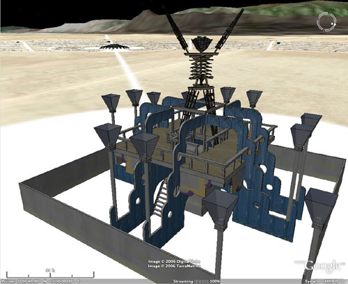
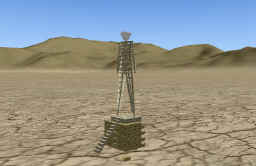
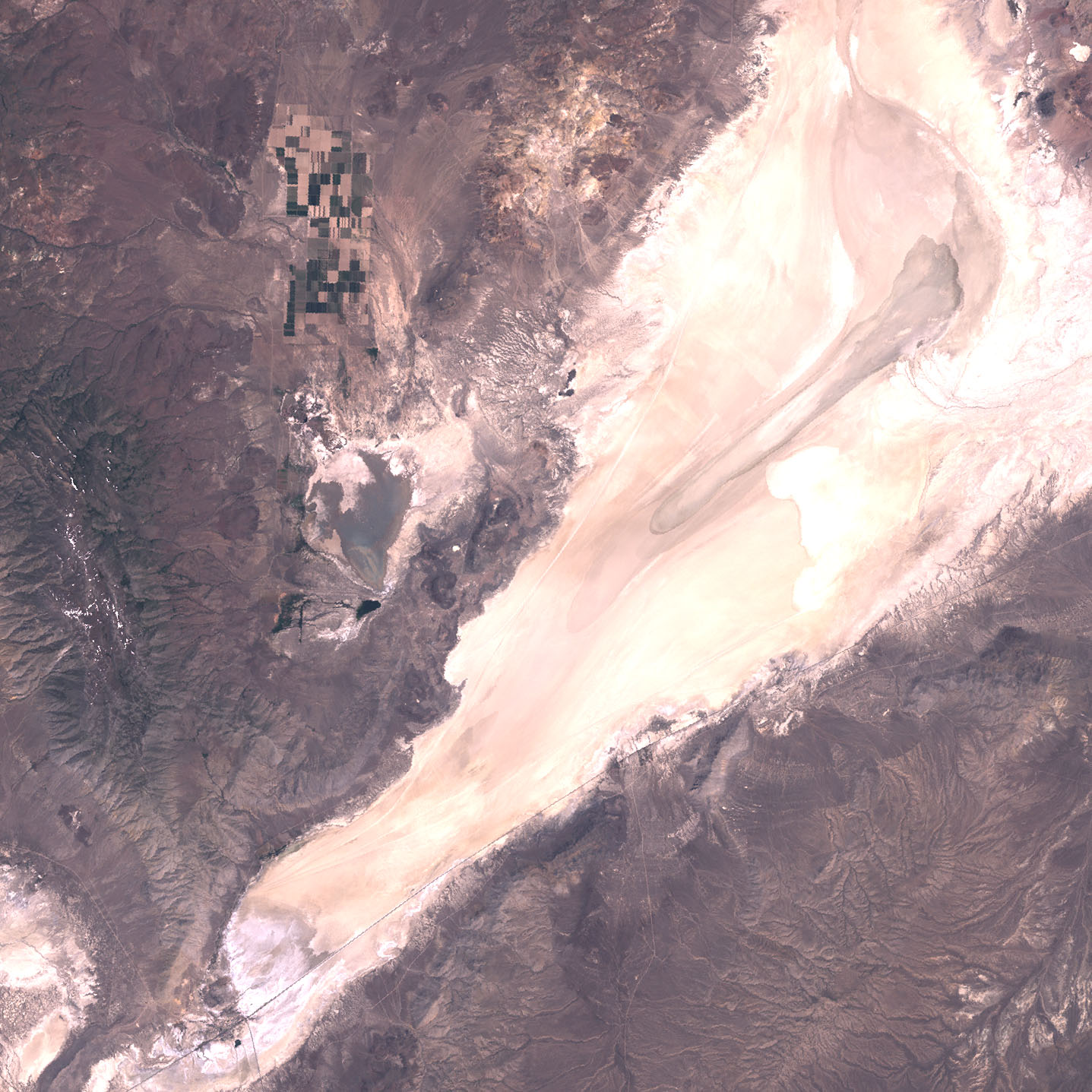
 cracked-mud
texture created from a photograph of the Black Rock Desert floor, used as a
repeating detail texture on the entire terrain
cracked-mud
texture created from a photograph of the Black Rock Desert floor, used as a
repeating detail texture on the entire terrain1-degree DEM
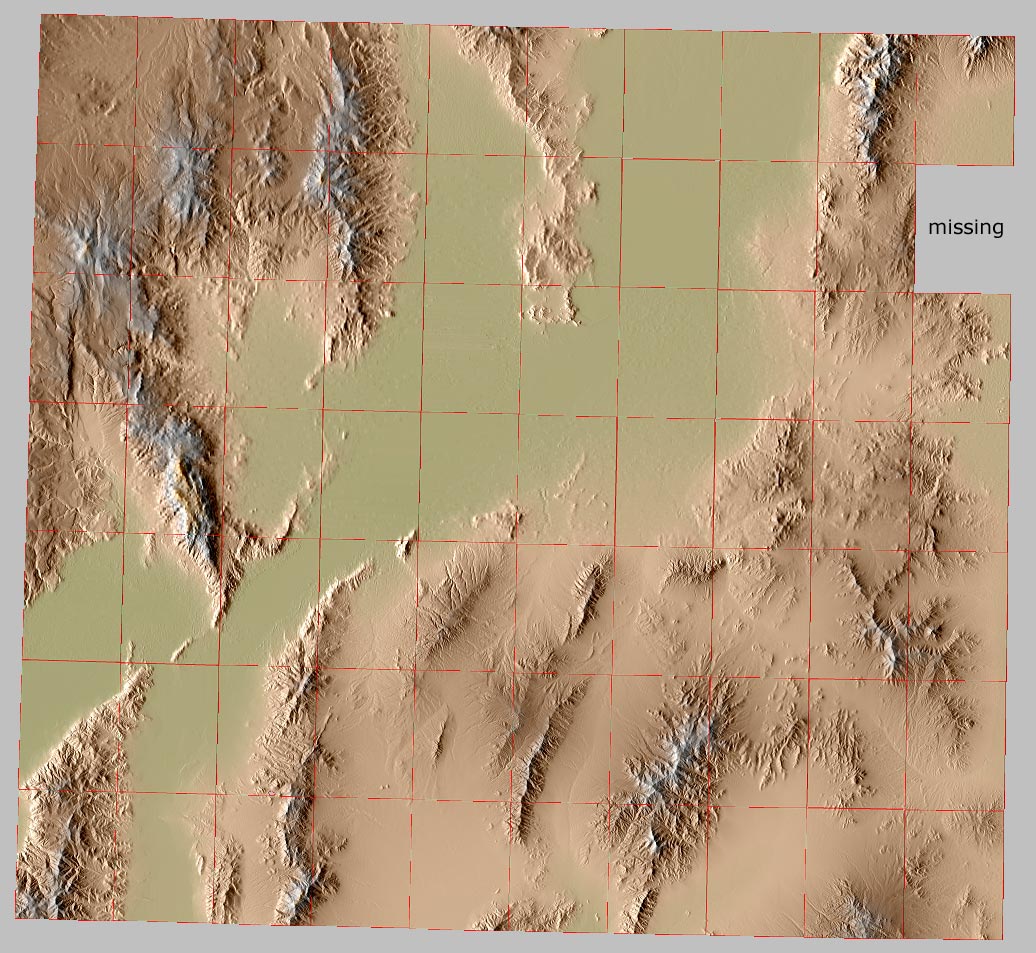 problem:
it is a terribly tedious operation to individually browse to, download,
decompress, rename, and import the large number of cryptically-named quads
required to cover the area
problem:
it is a terribly tedious operation to individually browse to, download,
decompress, rename, and import the large number of cryptically-named quads
required to cover the area