|
|
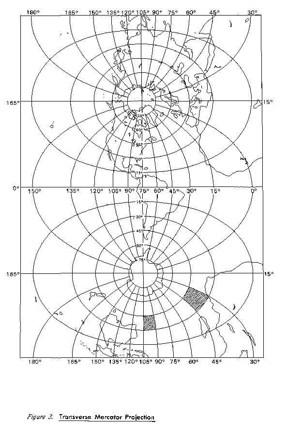
The UTM system was an attempt to set up a universal world wide system for mapping. The Transverse Mercator projection is used, with the cylinder in 60 positions. This creates 60 zones around the world. Positions are measured using Eastings and Northings, measured in meters, instead of Latitude and Longitude. Eastings start at 500,000 on the centre line of each zone. In the Northern Hemisphere, Northings are zero at the equator and increase northward. In the Southern Hemisphere, Northings start at 10 million at the equator, and decrease southward. You must know which hemisphere and zone you are in to interpret your location globally. Distortion of scale, distance, direction and area increase away from the central meridian.
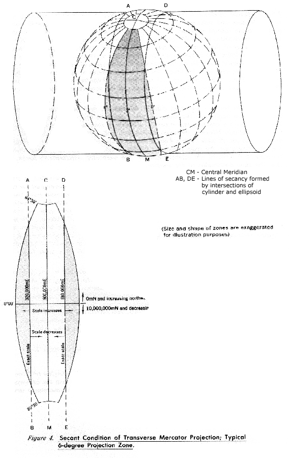
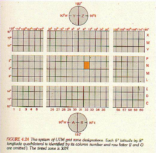
Put another way: UTM projection is used to define horizontal positions world-wide by dividing the surface of the Earth into 6 degree zones, each mapped by the Transverse Mercator projection with a central meridian in the center of the zone. UTM zone numbers designate 6 degree longitudinal strips extending from 80 degrees South latitude to 84 degrees North latitude. UTM zone characters designate 8 degree zones extending north and south from the equator. Eastings are measured from the central meridian (with a 500 km false easting to insure positive coordinates). Northings are measured from the equator (with a 10,000 km false northing for positions south of the equator).
UTM is applied separately to the Northern and Southern Hemisphere, thus within a single UTM zone, a single X / Y pair of values will occur in both the Northern and Southern Hemisphere. To eliminate this confusion, and to speed location of points, a UTM zone is sometimes subdivided into 20 zones of Latitude. These grids can be further subdivided into 100,000 meter grid squares with double-letter designations. This subdivision by Latitude and further division into grid squares is generally referred to as the Military Grid Reference System (MGRS).
The unit of measurement of UTM is always meters.
The zones are numbered from 1 to 60 eastward, beginning at the 180th meridian. Some software uses negative zone numbers to indicate that the data is in the southern hemisphere, e.g. zone 19 is north of the equator, zone -19 is south of the equator.